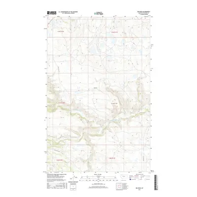
2017 Map of Big Rock
USGS Topo · Published 2017About this map
The Two-Medicine River and its S Fork Two-Medicine River branch across the high plains of Glacier County, defining the drainage patterns south of the Big Rock settlement. This landscape, surveyed in the early 21st century, is characterized by a network of local roads that bear the names of regional families and nearby landmarks, such as Morning Gun W Rd, Jerry Show W Rd, and the Heart Butte Cutoff. Small water bodies like Depot Cr and Elk Cr dot the northern reaches, while the terrain's topography reveals the complex glacial history of the area near the eastern edge of the Rocky Mountains. The presence of RR Rd suggest former or existing corridors through these ranching and tribal lands, where wide-open spaces are segmented by section lines of the Public Land Survey System.
Find a feature on this map
17 named features on this map. Tap any name to fly to it.
Don’t see what you’re looking for? This feature index may not catch every label — zoom into the map to look around manually.
Map Details
Editions of this 2017 Big Rock Map
This is the sole edition of this map. No revisions or reprints were ever made.
Other maps of this area

1901 · Browning
USGS Topo · 1:125,000

1903 · Browning
USGS Topo · 1:125,000

1911 · Blackfoot
USGS Topo · 1:125,000

1913 · Marias Pass
USGS Topo · 1:125,000

1914 · Heart Butte
USGS Topo · 1:125,000

1918 · Heart Butte
USGS Topo · 1:125,000

1960 · Cut Bank
USGS Topo · 1:250,000

1963 · Cut Bank
USGS Topo · 1:250,000

1964 · Cut Bank
USGS Topo · 1:250,000

1968 · Half Dome Crag
USGS Topo · 1:24,000