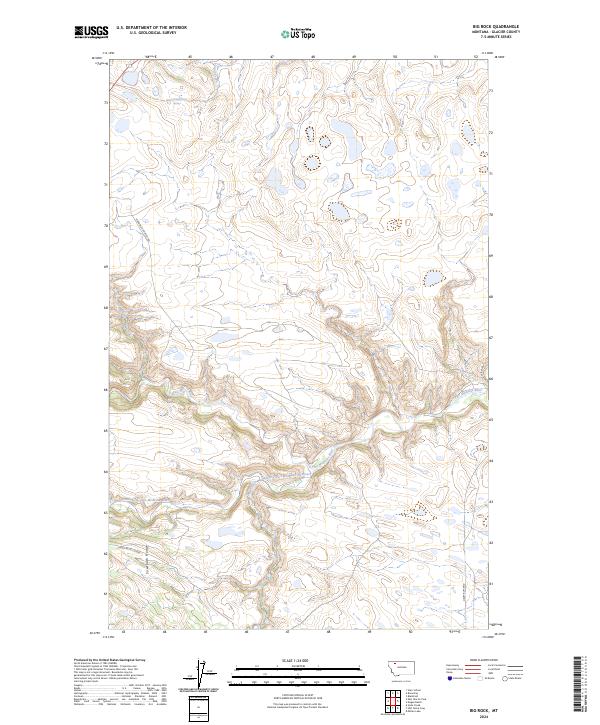
2024 Map of Big Rock
USGS Topo · Published 2024About this map
The Two Medicine River and its South Fork Two Medicine River carve through this section of Glacier County, Montana, defining a landscape of high-altitude drainage and complex topography. The presence of the Sawtooth Range in the southern portion of the map indicates the transition from the plains into the eastern front of the Rocky Mountains. This 2024 survey documents a sparsely settled region where the primary infrastructure consists of rural routes such as Morning Gun West Rd and Heart Butte Rd. Water sources are critical here, evidenced by the named Spring in the north and the confluence of tributaries like Depot Creek and Deer Creek. The map reflects a modern view of traditional Blackfeet Indian Reservation lands, showing the enduring paths of the Heart Butte Cutoff as it traverses the foothills.
Find a feature on this map
16 named features on this map. Tap any name to fly to it.
Don’t see what you’re looking for? This feature index may not catch every label — zoom into the map to look around manually.
Map Details
Editions of this 2024 Big Rock Map
This is the sole edition of this map. No revisions or reprints were ever made.
Other maps of this area

1901 · Browning
USGS Topo · 1:125,000

1903 · Browning
USGS Topo · 1:125,000

1911 · Blackfoot
USGS Topo · 1:125,000

1913 · Marias Pass
USGS Topo · 1:125,000

1914 · Heart Butte
USGS Topo · 1:125,000

1918 · Heart Butte
USGS Topo · 1:125,000

1960 · Cut Bank
USGS Topo · 1:250,000

1963 · Cut Bank
USGS Topo · 1:250,000

1964 · Cut Bank
USGS Topo · 1:250,000

1968 · Half Dome Crag
USGS Topo · 1:24,000