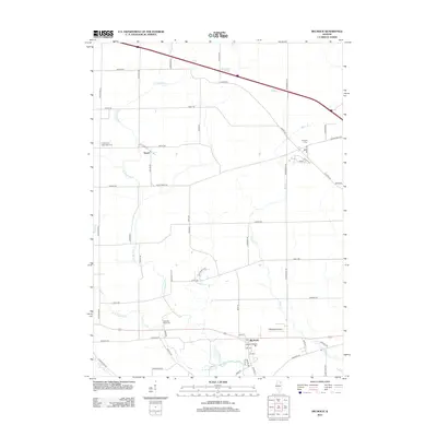
2012 Map of Big Rock
USGS Topo · Published 2012About this map
Big Rock and the surrounding Kane County farmland appear here in a transition toward modernization while maintaining a grid of rural roads and established homesteads. The village center at Big Rock is situated along Hinckley Rd and Shaw Rd, just north of the winding Big Rock Creek. Significant genealogical markers are scattered throughout the landscape, including the West Big Rock Cem and Kaneville Cem further north.
Find a feature on this map
58 named features on this map. Tap any name to fly to it.
Don’t see what you’re looking for? This feature index may not catch every label — zoom into the map to look around manually.
Map Details
Editions of this 2012 Big Rock Map
This is the sole edition of this map. No revisions or reprints were ever made.
Other maps of this area

1925 · Yorkville
USGS Topo · 1:62,500

1932 · Geneva
USGS Topo · 1:62,500

1937 · Sycamore
USGS Topo · 1:62,500

1948 · Geneva
USGS Topo · 1:62,500

1948 · Sandwich
USGS Topo · 1:62,500

1950 · Sandwich
USGS Topo · 1:62,500

1953 · Yorkville
USGS Topo · 1:24,000
1954 · Yorkville
USGS Topo · 1:62,500

1958 · Aurora
USGS Topo · 1:250,000

1961 · Aurora
USGS Topo · 1:250,000