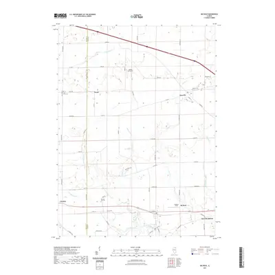
2021 Map of Big Rock
USGS Topo · Published 2021About this map
Kaneville and the village of Big Rock serve as the primary hubs for this agricultural landscape along the DeKalb and Kane county line. The terrain is defined by a sophisticated network of water management features, including the Malgren Drain, Swan Drain, and Duffin Drain, which channel water toward larger arteries like Welch Cr and the W Br Big Rock Cr. These drainage systems are essential to the vast farmlands that surround smaller settlements like Troxel.
Find a feature on this map
56 named features on this map. Tap any name to fly to it.
Don’t see what you’re looking for? This feature index may not catch every label — zoom into the map to look around manually.
Map Details
Editions of this 2021 Big Rock Map
This is the sole edition of this map. No revisions or reprints were ever made.
Other maps of this area

1925 · Yorkville
USGS Topo · 1:62,500

1932 · Geneva
USGS Topo · 1:62,500

1937 · Sycamore
USGS Topo · 1:62,500

1948 · Geneva
USGS Topo · 1:62,500

1948 · Sandwich
USGS Topo · 1:62,500

1950 · Sandwich
USGS Topo · 1:62,500

1953 · Yorkville
USGS Topo · 1:24,000
1954 · Yorkville
USGS Topo · 1:62,500

1958 · Aurora
USGS Topo · 1:250,000

1961 · Aurora
USGS Topo · 1:250,000