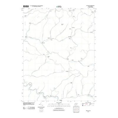
2011 Map of Big Run
USGS Topo · Published 2011About this map
North Fork Fishing Creek and its many tributaries, such as Willey Fork and North Fork Richwood Run, carve through the hills of Wetzel County in this 2011 survey. The settlement of Big Run serves as a local hub, featuring the Big Run Post Office and a network of county roads that follow the winding creek beds. This map is particularly valuable for genealogists, as it identifies numerous family-named burial sites scattered across the ridges and hollows, including the Anderson-Bane Cemetery and Lieuts-Bates Cemetery.
Find a feature on this map
93 named features on this map. Tap any name to fly to it.
Don’t see what you’re looking for? This feature index may not catch every label — zoom into the map to look around manually.
Map Details
Editions of this 2011 Big Run Map
This is the sole edition of this map. No revisions or reprints were ever made.
Other maps of this area

1902 · Clarksburg
USGS Topo · 1:62,500

1903 · Littleton
USGS Topo · 1:62,500

1905 · Mannington
USGS Topo · 1:62,500

1905 · Centerpoint
USGS Topo · 1:62,500

1905 · Littleton
USGS Topo · 1:62,500

1910 · Clarksburg
USGS Topo · 1:62,500

1923 · Mannington
USGS Topo · 1:62,500

1923 · Clarksburg
USGS Topo · 1:62,500

1924 · Centerpoint
USGS Topo · 1:62,500

1924 · Littleton
USGS Topo · 1:62,500