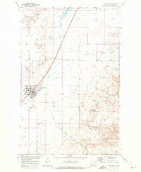
1969 Map of Big Sandy
USGS Topo · Published 1972About this map
Big Sandy serves as the focal point of this North Central Montana survey, situated along the Burlington Northern railroad line. The landscape is defined by the winding course of Big Sandy Creek and the notable elevation of Rattlesnake Butte to the southeast. For local historians, the town site includes several essential community markers from the late 1960s, including Miley Sch, a local Cem, and the Big Sandy Airport.
Find a feature on this map
18 named features on this map. Tap any name to fly to it.
Don’t see what you’re looking for? This feature index may not catch every label — zoom into the map to look around manually.
Map Details
Editions of this 1969 Big Sandy Map
This is the sole edition of this map. No revisions or reprints were ever made.
Other maps of this area

1904 · Boxelder
USGS Topo · 1:62,500

1906 · Boxelder
USGS Topo · 1:62,500

1919 · Big Sandy
USGS Topo · 1:125,000

1953 · Verona
USGS Topo · 1:24,000

1953 · Lonetree Coulee
USGS Topo · 1:24,000

1953 · Havre
USGS Topo · 1:250,000

1954 · Shelby
USGS Topo · 1:250,000

1957 · Havre
USGS Topo · 1:250,000

1958 · Shelby
USGS Topo · 1:250,000

1958 · Havre
USGS Topo · 1:250,000