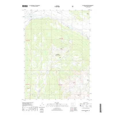
2017 Map of Big Sheep Mountain
USGS Topo · Published 2017About this map
Bridger National Forest defines this high-elevation landscape, where the upper reaches of the Green River snake through the northern portion of the quadrangle. The terrain is characterized by massive landmarks such as Big Sheep Mtn and Battleship Mtn, with the waterway at Big Bend serving as a significant geographical anchor. Access to this wilderness is traced by several forest roads, including Green River Lakes Rd and Gypsum Creek Rd, which navigate the drainages and ridges.
Find a feature on this map
27 named features on this map. Tap any name to fly to it.
Don’t see what you’re looking for? This feature index may not catch every label — zoom into the map to look around manually.
Map Details
Editions of this 2017 Big Sheep Mountain Map
This is the sole edition of this map. No revisions or reprints were ever made.
Other maps of this area

1907 · Gros Ventre
USGS Topo · 1:125,000

1909 · Fremont Peak
USGS Topo · 1:125,000

1910 · Gros Ventre
USGS Topo · 1:125,000

1955 · Driggs
USGS Topo · 1:250,000

1955 · Thermopolis
USGS Topo · 1:250,000

1958 · Driggs
USGS Topo · 1:250,000

1958 · Thermopolis
USGS Topo · 1:250,000

1962 · Thermopolis
USGS Topo · 1:250,000

1962 · Driggs
USGS Topo · 1:250,000
1966 · Dodge Butte
USGS Topo · 1:24,000