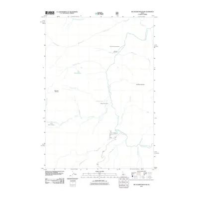
2011 Map of Big Soldier Mountain
USGS Topo · Published 2011About this map
Middle Fork Salmon River carves through the center of this terrain, serving as the primary drainage for a network of high-altitude tributaries including Elkhorn Creek and Sulphur Creek. The landscape is dominated by the elevations of Big Soldier Mountain and Morehead Mountain, creating a complex topography of ridges and basins. Human activity is concentrated along the river corridor and road access points, with backcountry aviation supported by the Morgan Ranch Airport and localized settlement at Sulphur Creek Ranch.
Find a feature on this map
24 named features on this map. Tap any name to fly to it.
Don’t see what you’re looking for? This feature index may not catch every label — zoom into the map to look around manually.
Map Details
Editions of this 2011 Big Soldier Mountain Map
This is the sole edition of this map. No revisions or reprints were ever made.
Other maps of this area

1891 · Bear Valley
USGS Topo · 1:125,000

1893 · Bear Valley
USGS Topo · 1:125,000

1957 · Challis
USGS Topo · 1:250,000

1960 · Challis
USGS Topo · 1:250,000

1961 · Greyhound Ridge
USGS Topo · 1:62,500

1961 · Chinook Mtn
USGS Topo · 1:62,500

1963 · Challis
USGS Topo · 1:250,000
1972 · Blue Bunch Mtn
USGS Topo · 1:24,000
1972 · Cape Horn Lakes
USGS Topo · 1:24,000
1972 · Bear Valley Mtn
USGS Topo · 1:24,000