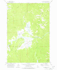
1972 Map of Blue Bunch Mtn
USGS Topo · Published 1977About this map
Blue Bunch Ridge and the heights of Blue Bunch Mtn dominate the northeastern portion of this Boise National Forest landscape. The terrain below is defined by an expansive system of high-altitude clearings, including Bear Valley Meadows, Bruce Meadows, and Ayers Meadows, where Bear Valley Creek and Ayers Creek converge. The prevalence of these meadows and numerous Spring sites historically supported seasonal grazing and backcountry travel before more modern recreational use.
Find a feature on this map
34 named features on this map. Tap any name to fly to it.
Don’t see what you’re looking for? This feature index may not catch every label — zoom into the map to look around manually.
Map Details
Editions of this 1972 Blue Bunch Mtn Map
2 editions found
Other maps of this area

1891 · Bear Valley
USGS Topo · 1:125,000

1893 · Bear Valley
USGS Topo · 1:125,000

1957 · Challis
USGS Topo · 1:250,000

1960 · Challis
USGS Topo · 1:250,000

1961 · Greyhound Ridge
USGS Topo · 1:62,500

1961 · Chinook Mtn
USGS Topo · 1:62,500

1963 · Challis
USGS Topo · 1:250,000

1972 · Bull Trout Point
USGS Topo · 1:24,000
1972 · Banner Summit
USGS Topo · 1:24,000

1972 · Cache Creek
USGS Topo · 1:24,000