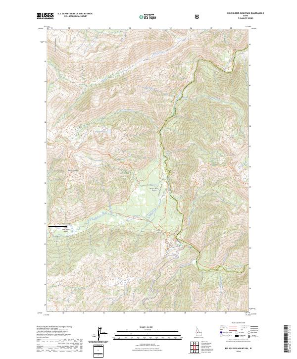
2024 Map of Big Soldier Mountain
USGS Topo · Published 2024About this map
The Middle Fork Salmon River carves a deep corridor through this central Idaho landscape, marking the boundary between the Challis National Forest and the Boise National Forest. Located within the Frank Church-River of No Return Wilderness, the area is defined by its significant relief and lack of modern road infrastructure, relying instead on a network of backcountry trails like the Middle Fork Trl and the Sulphur Creek Trl. Remote airstrips such as the Morgan Ranch Airport and Sulphur Creek Ranch Airport provide the primary points of access for this interior wilderness. High-elevation points like Big Soldier Mtn and Morehead Mtn tower over drainages like Elkhorn Creek and Dagger Creek. Near the southern edge, the site of Dagger Falls marks a prominent point of interest along the river corridor.
Find a feature on this map
48 named features on this map. Tap any name to fly to it.
Don’t see what you’re looking for? This feature index may not catch every label — zoom into the map to look around manually.
Map Details
Editions of this 2024 Big Soldier Mountain Map
This is the sole edition of this map. No revisions or reprints were ever made.
Other maps of this area

1891 · Bear Valley
USGS Topo · 1:125,000

1893 · Bear Valley
USGS Topo · 1:125,000

1957 · Challis
USGS Topo · 1:250,000

1960 · Challis
USGS Topo · 1:250,000

1961 · Greyhound Ridge
USGS Topo · 1:62,500

1961 · Chinook Mtn
USGS Topo · 1:62,500

1963 · Challis
USGS Topo · 1:250,000
1972 · Blue Bunch Mtn
USGS Topo · 1:24,000
1972 · Cape Horn Lakes
USGS Topo · 1:24,000
1972 · Bear Valley Mtn
USGS Topo · 1:24,000