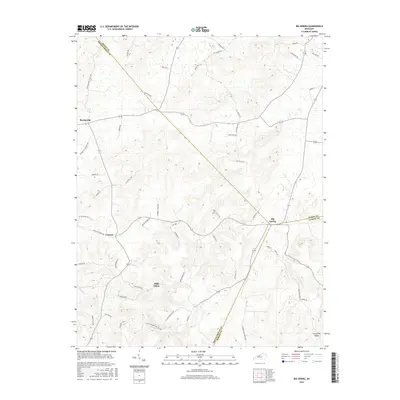
2016 Map of Big Spring
USGS Topo · Published 2016About this map
Big Spring sits at the intersection of three counties, marking a significant point of convergence in the Kentucky landscape where the boundaries of Meade, Breckinridge, and Hardin counties meet. The area is defined by its small upland settlements like Bewleyville, Corners, and High Plains, which are linked by an intricate network of rural roads that often follow the undulating topography. In the southeast, the terrain drops into Losenville Valley, while drainage across the quadrangle is provided by waterways such as Blue Fork and Mays Run. The road network is heavily informed by local geography and history, featuring family and descriptive names like St Clair Cemetery Rd, Bennett Cem Rd, and Custer-Roberts Hollow Rd. This layout suggests a long-standing pattern of family-centered farming and localized transit routes that have persisted into the modern era.
Find a feature on this map
55 named features on this map. Tap any name to fly to it.
Don’t see what you’re looking for? This feature index may not catch every label — zoom into the map to look around manually.
Map Details
Editions of this 2016 Big Spring Map
This is the sole edition of this map. No revisions or reprints were ever made.
Other maps of this area

1928 · Hardinsburg
USGS Topo · 1:48,000

1931 · Hardinsburg
USGS Topo · 1:62,500

1932 · Big Clifty
USGS Topo · 1:62,500

1941 · Ekron
USGS Topo · 1:62,500

1946 · Rock Haven
USGS Topo · 1:24,000

1947 · Irvington
USGS Topo · 1:24,000

1947 · Garfield
USGS Topo · 1:24,000

1947 · Hardinsburg
USGS Topo · 1:62,500

1947 · Ekron
USGS Topo · 1:62,500
1948 · Guston
USGS Topo · 1:24,000