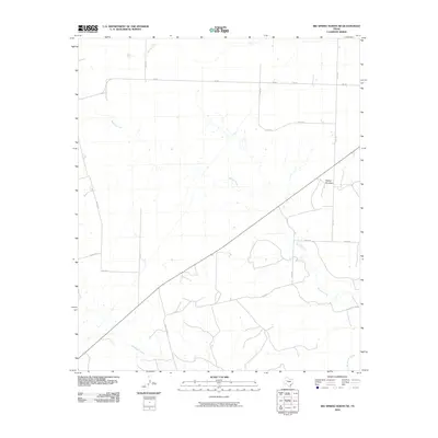
2010 Map of Big Spring North NE
USGS Topo · Published 2010About this map
Morgan Creek and its seasonal tributaries carve a winding path across this West Texas landscape, defining the local drainage patterns northeast of Big Spring. The terrain is relatively uniform except for the prominent rise of Flattop Mountain in the eastern portion of the sheet. This 2010 survey illustrates a rural environment shaped by a grid of ranch and farm-to-market roads, including Fm 846 and Fm 845, which facilitate movement across the sparse territory. The presence of Wildhorse Creek and Willow Creek further highlights the importance of water management in this arid region, where small tanks and ponds dot the landscape near established property lines. This map serves as a clear record of the modern transportation infrastructure and land use in this part of Howard County.
Find a feature on this map
16 named features on this map. Tap any name to fly to it.
Don’t see what you’re looking for? This feature index may not catch every label — zoom into the map to look around manually.
Map Details
Editions of this 2010 Big Spring North NE Map
This is the sole edition of this map. No revisions or reprints were ever made.
Other maps of this area

1942 · Big Spring North
USGS Topo · 1:62,500

1951 · Ira SW
USGS Topo · 1:24,000

1951 · Vincent
USGS Topo · 1:24,000

1951 · Iatan
USGS Topo · 1:24,000

1952 · Iatan
USGS Topo · 1:24,000

1954 · Big Spring
USGS Topo · 1:250,000

1954 · Big Spring North
USGS Topo · 1:24,000

1954 · Big Spring North NE
USGS Topo · 1:24,000

1958 · Big Spring
USGS Topo · 1:250,000

1965 · Big Spring North
USGS Topo · 1:24,000