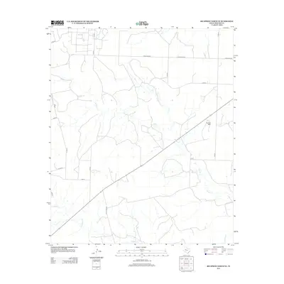
2012 Map of Big Spring North NE
USGS Topo · Published 2012About this map
Morgan Creek meanders across this West Texas landscape, defining the drainage patterns of the Llano Estacado region north of Big Spring. This 2012 survey by the U.S. Geological Survey illustrates a sparsely populated section of Howard County where cattle ranching and modern energy infrastructure share the land. The terrain is marked by the prominent rise of Flattop Mountain in the east, providing a rare vertical landmark in an area otherwise characterized by wide plains and subtle creek beds like Wildhorse Creek and Willow Creek. The map details a geometric grid of county roads and larger thoroughfares, including Ranch Road 846 and Ranch Road 820, which facilitate movement through this ranching territory. These routes connect isolated homesteads and industrial sites to the broader regional network, reflecting the enduring rural character of the Texas Panhandle fringe.
Find a feature on this map
16 named features on this map. Tap any name to fly to it.
Don’t see what you’re looking for? This feature index may not catch every label — zoom into the map to look around manually.
Map Details
Editions of this 2012 Big Spring North NE Map
This is the sole edition of this map. No revisions or reprints were ever made.
Other maps of this area

1942 · Big Spring North
USGS Topo · 1:62,500

1951 · Ira SW
USGS Topo · 1:24,000

1951 · Vincent
USGS Topo · 1:24,000

1951 · Iatan
USGS Topo · 1:24,000

1952 · Iatan
USGS Topo · 1:24,000

1954 · Big Spring
USGS Topo · 1:250,000

1954 · Big Spring North
USGS Topo · 1:24,000

1954 · Big Spring North NE
USGS Topo · 1:24,000

1958 · Big Spring
USGS Topo · 1:250,000

1965 · Big Spring North
USGS Topo · 1:24,000