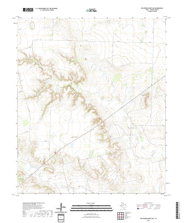
2022 Map of Big Spring North NE
USGS Topo · Published 2022About this map
Morgan Creek and its complex network of feeder draws define the central topography of this West Texas landscape northeast of the city of Big Spring. The terrain is characterized by the prominent elevation of Flattop Mountain, a distinctive landmark in the northeastern portion of the sheet. To the south, the watershed transitions toward Wildhorse Creek, while Willow Creek drains the northern reaches near the border of Farm to Market Road 846.
Find a feature on this map
18 named features on this map. Tap any name to fly to it.
Don’t see what you’re looking for? This feature index may not catch every label — zoom into the map to look around manually.
Map Details
Editions of this 2022 Big Spring North NE Map
This is the sole edition of this map. No revisions or reprints were ever made.
Other maps of this area

1942 · Big Spring North
USGS Topo · 1:62,500

1951 · Ira SW
USGS Topo · 1:24,000

1951 · Vincent
USGS Topo · 1:24,000

1951 · Iatan
USGS Topo · 1:24,000

1952 · Iatan
USGS Topo · 1:24,000

1954 · Big Spring
USGS Topo · 1:250,000

1954 · Big Spring North
USGS Topo · 1:24,000

1954 · Big Spring North NE
USGS Topo · 1:24,000

1958 · Big Spring
USGS Topo · 1:250,000

1965 · Big Spring North
USGS Topo · 1:24,000