
1893 Map of Big Springs
USGS Topo · Published 1893About this map
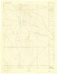
El Paso and surrounding frontier counties are captured here in the late 1880s, revealing a landscape defined by isolated homesteads and seasonal watercourses. The settlement at Big Springs serves as a central point in an area where the transition from open range to ranching is evidenced by family holdings such as Galloway Ranch and Hancock Ranch. These established sites, along with the distinctively named Crows Roost, provide critical geographic anchors for genealogists tracing early cattle-country pioneers. Drainage patterns across the high plains are documented through the winding paths of Black Squirrel Creek and Steel's Fork, which were vital for sustaining livestock and early agriculture. The northern terrain is marked by the Holcolm Hills, while the northeastern corner shows the small outpost of Holtwold in Elbert County, illustrating the sparse network of settlements that existed before more intensive development reached this portion of eastern Colorado.
Find a feature on this map
15 named features on this map. Tap any name to fly to it.
Don’t see what you’re looking for? This feature index may not catch every label — zoom into the map to look around manually.
Map Details
Editions of this 1893 Big Springs Map
5 editions found
Other maps of this area

1889 · Sanborn
USGS Topo · 1:125,000

1891 · Sanborn
USGS Topo · 1:125,000

1891 · Catlin
USGS Topo · 1:125,000

1891 · Pueblo
USGS Topo · 1:125,000

1891 · Nepesta
USGS Topo · 1:125,000

1891 · Limon
USGS Topo · 1:125,000

1892 · Limon
USGS Topo · 1:125,000

1893 · Nepesta
USGS Topo · 1:125,000

1893 · Sanborn
USGS Topo · 1:125,000

1893 · Catlin
USGS Topo · 1:125,000