
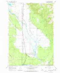
1964 Map of Big Springs
USGS Topo · Published 1966About this map
Big Springs sits at the heart of this mid-1960s survey, where the water-rich geography of eastern Idaho meets the Union Pacific railroad line. The landscape is dominated by the sprawling Henrys Lake Flat and the northern reaches of the Targhee National Forest. This era shows a mix of recreational development and resource extraction, evidenced by the Island Park Golf Course and several prospects and borrow pits scattered near the timberline.
Find a feature on this map
33 named features on this map. Tap any name to fly to it.
Don’t see what you’re looking for? This feature index may not catch every label — zoom into the map to look around manually.
Map Details
Editions of this 1964 Big Springs Map
2 editions found
Other maps of this area

1955 · Ashton
USGS Topo · 1:250,000

1957 · Buffalo Lake
USGS Topo · 1:62,500

1958 · Ashton
USGS Topo · 1:250,000

1958 · West Yellowstone
USGS Topo · 1:62,500

1960 · Ashton
USGS Topo · 1:250,000

1964 · Island Park
USGS Topo · 1:24,000

1964 · Island Park Dam
USGS Topo · 1:24,000

1964 · Targhee Pass
USGS Topo · 1:24,000

1964 · Targhee Peak
USGS Topo · 1:24,000

1964 · Sawtell PK
USGS Topo · 1:24,000