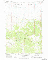
1968 Map of Big Table Mountain
USGS Topo · Published 1984About this map
The Continental Divide winds across this high-country landscape, marking the rugged boundary between Montana and Idaho. In the late 1960s, this area of the Centennial Mountains remained largely undeveloped, dominated by the sprawling acreage of the Targhee National Forest and the open expanses of the Centennial Valley. The map detail reveals a high-altitude ranching and wilderness economy, centered around the Jones Ranch and the specialized infrastructure of the Price Peet Road. A complex drainage system feeds into Peet Creek, Bean Creek, and Bear Creek, while prominent geological landmarks like Big Table Mountain and Little Table Mountain provide natural navigational points. The survey also captures specific local divides such as the Price-Peet Divide and Pete Creek Divide, which define the hydrological character of this remote border region.
Find a feature on this map
28 named features on this map. Tap any name to fly to it.
Don’t see what you’re looking for? This feature index may not catch every label — zoom into the map to look around manually.
Map Details
Editions of this 1968 Big Table Mountain Map
3 editions found
Other maps of this area

1950 · Lower Red Rock Lake
USGS Topo · 1:62,500

1955 · Dubois
USGS Topo · 1:250,000

1955 · Ashton
USGS Topo · 1:250,000

1958 · Dubois
USGS Topo · 1:250,000

1958 · Ashton
USGS Topo · 1:250,000

1960 · Ashton
USGS Topo · 1:250,000

1968 · Corral Creek
USGS Topo · 1:24,000

1968 · Big Table Mountain
USGS Topo · 1:24,000

1968 · Antelope Peak
USGS Topo · 1:24,000
1968 · Wolverine Creek
USGS Topo · 1:24,000