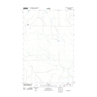
2011 Map of Big Wall NW
USGS Topo · Published 2011About this map
Flatwillow Colony stands as a focal point in this portion of the Musselshell County landscape, representing the communal agricultural traditions of the region. The map documents a sparse but vital network of water and transit, where Colony Rd and Crawford Rd provide the primary links across the drainage basins of Little Wall Creek and Crooked Creek. The presence of Ivy Dam highlights the essential role of water management in this environment, creating a localized reservoir for the surrounding area. This topographic study reflects the modern character of the Montana plains, where large-scale land use and specific settlement patterns are shaped by the availability of seasonal water sources and organized rural planning.
Find a feature on this map
6 named features on this map. Tap any name to fly to it.
Don’t see what you’re looking for? This feature index may not catch every label — zoom into the map to look around manually.
Map Details
Editions of this 2011 Big Wall NW Map
This is the sole edition of this map. No revisions or reprints were ever made.
Other maps of this area

1954 · Roundup
USGS Topo · 1:250,000

1958 · Roundup
USGS Topo · 1:250,000

1986 · Lake Mason SE
USGS Topo · 1:24,000

1986 · Lake Mason NE
USGS Topo · 1:24,000

1986 · Flatwillow
USGS Topo · 1:24,000

1986 · Pike Creek Hills East
USGS Topo · 1:24,000

1986 · Crowley Dam
USGS Topo · 1:24,000

1986 · Big Wall West
USGS Topo · 1:24,000

1986 · Big Wall NW
USGS Topo · 1:24,000
1986 · Big Wall East
USGS Topo · 1:24,000
Featured Places
- Sunset Hutterite Colony, MT
- Flatwillow Hutterite Colony, MT
- Petroleum County, MT
- Musselshell County, MT
- United States