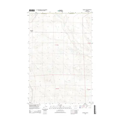
2014 Map of Big Wall NW
USGS Topo · Published 2014About this map
Flatwillow Colony sits at the intersection of a vast ranching and energy-producing landscape in Musselshell County. This 2014 survey documents a region defined by its drainage systems and natural resources, notably the Big Wall Oil Field in the southeastern quadrant. The terrain is marked by significant topographical shifts, moving from the open plains around Colony Rd and N Colony Way into the distinctive depression of the Devils Basin.
Find a feature on this map
13 named features on this map. Tap any name to fly to it.
Don’t see what you’re looking for? This feature index may not catch every label — zoom into the map to look around manually.
Map Details
Editions of this 2014 Big Wall NW Map
This is the sole edition of this map. No revisions or reprints were ever made.
Other maps of this area

1954 · Roundup
USGS Topo · 1:250,000

1958 · Roundup
USGS Topo · 1:250,000

1986 · Lake Mason SE
USGS Topo · 1:24,000

1986 · Lake Mason NE
USGS Topo · 1:24,000

1986 · Flatwillow
USGS Topo · 1:24,000

1986 · Pike Creek Hills East
USGS Topo · 1:24,000

1986 · Crowley Dam
USGS Topo · 1:24,000

1986 · Big Wall West
USGS Topo · 1:24,000

1986 · Big Wall NW
USGS Topo · 1:24,000
1986 · Big Wall East
USGS Topo · 1:24,000
Featured Places
- Sunset Hutterite Colony, MT
- Flatwillow Hutterite Colony, MT
- Petroleum County, MT
- Musselshell County, MT
- United States