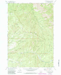
1972 Map of Big Weasel Sprs
USGS Topo · Published 1984About this map
The Aldrich Mountains define the high-elevation landscape of this interior Oregon region, dominated by the timber and watershed of the Malheur National Forest. In the early 1970s, this area remained largely remote, marked by a network of drainage systems like Murderers Creek and Fields Creek. The map documents a history of seasonal occupation and resource extraction, visible in the scattered locations of the Buck Cabin (Site), Stewart Cabin, and Lemon Cabin.
Find a feature on this map
49 named features on this map. Tap any name to fly to it.
Don’t see what you’re looking for? This feature index may not catch every label — zoom into the map to look around manually.
Map Details
Editions of this 1972 Big Weasel Sprs Map
2 editions found
Other maps of this area

1940 · Mount Vernon
USGS Topo · 1:62,500

1940 · Aldrich Mtn.
USGS Topo · 1:62,500

1943 · Aldrich Mtn.
USGS Topo · 1:62,500

1943 · Mount Vernon
USGS Topo · 1:62,500

1955 · Canyon City
USGS Topo · 1:250,000

1959 · Canyon City
USGS Topo · 1:250,000

1961 · Logdell
USGS Topo · 1:62,500

1961 · Izee
USGS Topo · 1:62,500

1972 · Big Weasel Sprs
USGS Topo · 1:24,000
1972 · Mc Clellan Mtn
USGS Topo · 1:24,000