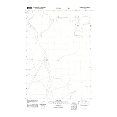
2011 Map of Big Windy Peak
USGS Topo · Published 2011About this map
Big Windy Peak and the high ridges of Spring Mountain dominate this part of the Lemhi Range in Custer County. In the early 21st century, the landscape is defined by an intricate network of drainage systems and forest roads that facilitate access to high-elevation landmarks. High basins feed water into Sawmill Creek, Garfield Creek, and Warm Creek, while isolated water sources like Horse Lake and Y Springs provide essential points for backcountry navigation.
Find a feature on this map
25 named features on this map. Tap any name to fly to it.
Don’t see what you’re looking for? This feature index may not catch every label — zoom into the map to look around manually.
Map Details
Editions of this 2011 Big Windy Peak Map
This is the sole edition of this map. No revisions or reprints were ever made.
Other maps of this area

1955 · Dubois
USGS Topo · 1:250,000

1956 · Nicholia
USGS Topo · 1:62,500

1957 · Diamond Peak
USGS Topo · 1:62,500

1957 · Gilmore
USGS Topo · 1:62,500

1957 · Hawley Mountain
USGS Topo · 1:62,500

1958 · Dubois
USGS Topo · 1:250,000

1987 · Gilmore
USGS Topo · 1:24,000
1987 · Mulkey Bar
USGS Topo · 1:24,000
1987 · Gilmore Summit
USGS Topo · 1:24,000
1987 · Bell Mountain
USGS Topo · 1:24,000