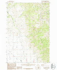
1987 Map of Big Windy Peak
USGS Topo · Published 1987About this map
Big Windy Peak towers over the high-elevation divide where Custer Co and Lemhi Co meet, anchoring a landscape shaped by rugged canyons and mountain resource extraction. The eastern slopes of the Lemhi Range are deeply incised by drainages such as Sawmill Canyon and Quartzite Canyon, which funnel toward the Little Lost River valley and its expansive Mud Flats. This 1987 survey records a distinct pattern of land use within the Challis National Forest, where the Fairview Guard Station and Corral indicate the infrastructure of forest management and grazing.
Find a feature on this map
37 named features on this map. Tap any name to fly to it.
Don’t see what you’re looking for? This feature index may not catch every label — zoom into the map to look around manually.
Map Details
Editions of this 1987 Big Windy Peak Map
This is the sole edition of this map. No revisions or reprints were ever made.
Other maps of this area

1955 · Dubois
USGS Topo · 1:250,000

1956 · Nicholia
USGS Topo · 1:62,500

1957 · Diamond Peak
USGS Topo · 1:62,500

1957 · Gilmore
USGS Topo · 1:62,500

1957 · Hawley Mountain
USGS Topo · 1:62,500

1958 · Dubois
USGS Topo · 1:250,000

1987 · Gilmore
USGS Topo · 1:24,000
1987 · Mulkey Bar
USGS Topo · 1:24,000
1987 · Gilmore Summit
USGS Topo · 1:24,000
1987 · Bell Mountain
USGS Topo · 1:24,000