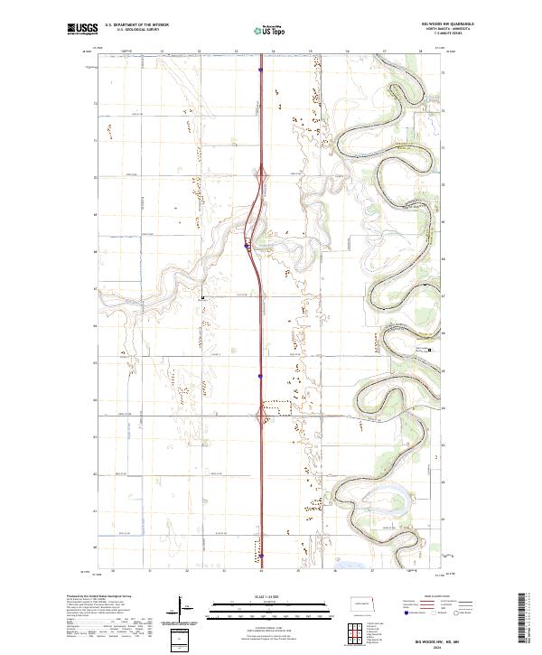
2024 Map of Big Woods NW
USGS Topo · Published 2024About this map
The Red River of the North forms a serpentine, highly braided natural boundary between Walsh County, North Dakota, and Marshall County, Minnesota. This flat, alluvial landscape is defined by the sharp meanders of the river and its tributary, the Park River, which cuts across the western plains to join the main channel. The map illustrates a strictly rectilinear section-line road grid, characteristic of the Red River Valley’s agricultural development, where routes like 70th St NE and Co Rd 11 provide access to remote farmsteads. Cultural markers are sparse but significant for local history, including the Saint Joseph Mission Cem near the riverbanks and the Zion Cem further west. Drainage projects, such as the Dipple Drain, demonstrate the engineering required to manage the seasonally wet prairie lands of this fertile border region.
Find a feature on this map
27 named features on this map. Tap any name to fly to it.
Don’t see what you’re looking for? This feature index may not catch every label — zoom into the map to look around manually.
Map Details
Editions of this 2024 Big Woods NW Map
This is the sole edition of this map. No revisions or reprints were ever made.
Other maps of this area

1918 · Acton
USGS Topo · 1:62,500

1939 · Drayton
USGS Topo · 1:62,500

1939 · Glasston
USGS Topo · 1:62,500

1941 · Drayton
USGS Topo · 1:62,500

1941 · Glasston
USGS Topo · 1:62,500

1943 · Grafton
USGS Topo · 1:62,500

1952 · Thief River Falls
USGS Topo · 1:250,000

1956 · Thief River Falls
USGS Topo · 1:250,000

1957 · Thief River Falls
USGS Topo · 1:250,000
1960 · Big Woods NW
USGS Topo · 1:24,000