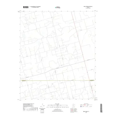
2019 Map of Bigby Corner
USGS Topo · Published 2019About this map
Glasscock County and Reagan County meet along a straight east-west boundary in this section of the Permian Basin region. The landscape is defined by an extensive grid of service roads and industrial infrastructure, characteristic of the area's energy production history. Major thoroughfares such as Farm Rd 2401 and Farm Rd 1357 provide the primary transit framework, while a dense network of local routes like Co Rd 113 and Co Rd 106 crisscross the terrain. The presence of Tank Farm Rd and Pecan Tree Rd points to the specific land uses that have shaped this West Texas environment, from industrial storage to localized agriculture. Researchers will find a highly structured interior, where the intersection of Ranch Rd 1800 and Ls 7 Rd marks the southeastern reaches of the survey.
Find a feature on this map
15 named features on this map. Tap any name to fly to it.
Don’t see what you’re looking for? This feature index may not catch every label — zoom into the map to look around manually.
Map Details
Editions of this 2019 Bigby Corner Map
This is the sole edition of this map. No revisions or reprints were ever made.
Other maps of this area

1954 · San Angelo
USGS Topo · 1:250,000

1958 · San Angelo
USGS Topo · 1:250,000

1965 · San Angelo
USGS Topo · 1:250,000

1965 · Dewey Lake SE
USGS Topo · 1:24,000

1965 · Pecks Lake
USGS Topo · 1:24,000

1965 · Patterson Lake
USGS Topo · 1:24,000

1967 · Midkiff
USGS Topo · 1:24,000

1968 · Midkiff SE
USGS Topo · 1:24,000

1973 · Saint Lawrence SE
USGS Topo · 1:24,000

1973 · Bigby Corner
USGS Topo · 1:24,000