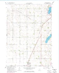
1960 Map of Bigelow
USGS Topo · Published 1977About this map
The Chicago and North Western railroad defines the agricultural corridor of southern Nobles County, running past the small settlement of Org and down toward the town of Bigelow on the Iowa border. This prairie landscape is marked by systematic drainage and water management, evidenced by the presence of Judicial Ditch No 1 and Judicial Ditch No 10 which channel water through the townships of Ransom and Dewald. To the northeast, the southern edge of Worthington borders Okabena Lake, with Stony Point reaching into the water.
Find a feature on this map
22 named features on this map. Tap any name to fly to it.
Don’t see what you’re looking for? This feature index may not catch every label — zoom into the map to look around manually.
Map Details
Editions of this 1960 Bigelow Map
2 editions found
Other maps of this area

1954 · Fairmont
USGS Topo · 1:250,000

1958 · Fairmont
USGS Topo · 1:250,000

1960 · Reading
USGS Topo · 1:24,000

1960 · Bigelow
USGS Topo · 1:24,000

1960 · Worthington North
USGS Topo · 1:24,000

1960 · Worthington South
USGS Topo · 1:24,000

1967 · Rushmore
USGS Topo · 1:24,000

1967 · Adrian NE
USGS Topo · 1:24,000

1972 · Ocheyedan
USGS Topo · 1:24,000

1972 · Sibley West
USGS Topo · 1:24,000