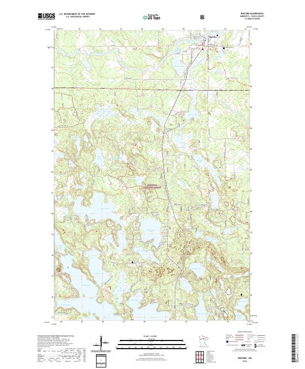
2022 Map of Bigfork
USGS Topo · Published 2022About this map
The Big Fork River winds through the northern reaches of Itasca County, defining the landscape around the settlement of Bigfork. This area, largely contained within the Chippewa National Forest, is characterized by a dense network of water bodies and marshlands, including the unique Rice Lake Bog and the Jingo Lake Impoundment. Local infrastructure is geared toward both industry and recreation, evidenced by Rajala Mill Rd and an extensive system of trails such as the Marcell N Snowmobile Trl and various Jingo Lake Spur routes.
Find a feature on this map
94 named features on this map. Tap any name to fly to it.
Don’t see what you’re looking for? This feature index may not catch every label — zoom into the map to look around manually.
Map Details
Editions of this 2022 Bigfork Map
This is the sole edition of this map. No revisions or reprints were ever made.
Other maps of this area

1918 · Zora
USGS Topo · 1:62,500

1919 · Zora
USGS Topo · 1:62,500

1919 · Marcell
USGS Topo · 1:62,500

1954 · Hibbing
USGS Topo · 1:250,000

1957 · Hibbing
USGS Topo · 1:250,000

1958 · Hibbing
USGS Topo · 1:250,000

1964 · Hibbing
USGS Topo · 1:250,000

1970 · Clubhouse Lake
USGS Topo · 1:24,000

1970 · Jessie Lake
USGS Topo · 1:24,000

1970 · Coon Lake
USGS Topo · 1:24,000