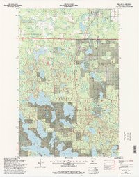
1996 Map of Bigfork
USGS Topo · Published 1998About this map
The Big Fork River carves through the northern reaches of Itasca County, defining a landscape where the Big Fork State Forest meets the Chippewa National Forest. The village of Bigfork sits at a strategic bend in the river, serving as a hub for the surrounding timber and recreational lands. To the south, the terrain is dominated by a dense network of glacial lakes, including the expansive Turtle Lake and Bello Lake, which reflect the region's deep-rooted connection to water-based transit and recreation.
Find a feature on this map
49 named features on this map. Tap any name to fly to it.
Don’t see what you’re looking for? This feature index may not catch every label — zoom into the map to look around manually.
Map Details
Editions of this 1996 Bigfork Map
This is the sole edition of this map. No revisions or reprints were ever made.
Other maps of this area

1918 · Zora
USGS Topo · 1:62,500

1919 · Zora
USGS Topo · 1:62,500

1919 · Marcell
USGS Topo · 1:62,500

1954 · Hibbing
USGS Topo · 1:250,000

1957 · Hibbing
USGS Topo · 1:250,000

1958 · Hibbing
USGS Topo · 1:250,000

1964 · Hibbing
USGS Topo · 1:250,000

1970 · Clubhouse Lake
USGS Topo · 1:24,000

1970 · Jessie Lake
USGS Topo · 1:24,000

1970 · Coon Lake
USGS Topo · 1:24,000