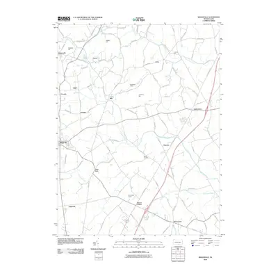
2010 Map of Biglerville
USGS Topo · Published 2010About this map
Biglerville anchors this section of the Adams County landscape, where the agricultural traditions of South Central Pennsylvania meet the winding corridors of Conewago Creek and Bermudian Creek. The map reveals a dense network of small historic settlements and rural junctions including Bendersville, Aspers, and Heidlersburg. Significant family and local landmarks define the terrain, from the elevations of Opossum Hill and Wolfpit Hill to the localized industries represented by Limerock Mill. Transportation patterns are established by a lattice of named rural routes like Old Carlisle Rd and Schoolhouse Rd, which connect long-standing communities such as Center Mills and Table Rock. The presence of the Shimerfield Airport near Shrivers Corners and the development around Hunterstown illustrate the evolving infrastructure of the region as it appeared in the early 21st century.
Find a feature on this map
97 named features on this map. Tap any name to fly to it.
Don’t see what you’re looking for? This feature index may not catch every label — zoom into the map to look around manually.
Map Details
Editions of this 2010 Biglerville Map
This is the sole edition of this map. No revisions or reprints were ever made.
Other maps of this area

1904 · Carlisle
USGS Topo · 1:62,500

1908 · Gettysburg
USGS Topo · 1:62,500

1909 · Fairfield
USGS Topo · 1:62,500

1919 · Newville
USGS Topo · 1:62,500

1942 · Gettysburg
USGS Topo · 1:125,000

1943 · Carlisle
USGS Topo · 1:62,500

1944 · Gettysburg
USGS Topo · 1:31,680

1944 · Mc Sherrystown
USGS Topo · 1:31,680

1944 · Arendtsville
USGS Topo · 1:31,680
1944 · Fairfield
USGS Topo · 1:31,680