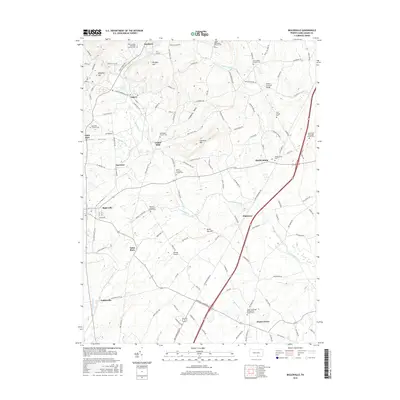
2016 Map of Biglerville
USGS Topo · Published 2016About this map
Heikes Covered Bridge spans the waters of Bermudian Creek in this portion of Adams County, where the landscape is defined by the winding paths of Conewago Creek and its many tributaries. The area is dense with historical sites of worship and burial, reflecting a deep-seated congregational history that includes the Menallen Friends Cemetery in Flora Dale and the Great Conewago Presbyterian Church Cemetery near Hunterstown. Small agricultural settlements like Gardners, Aspers, and Heidlersburg are connected by a network of rural routes such as Old Carlisle Road and Aspers-Benderville Road. Prominent local elevations including Wolfpit Hill and Stone Jug Hill rise above the valleys, while the Bowtie Airport sits near Table Rock, illustrating the modern layer of infrastructure laid over these long-established fruit-growing and farming communities.
Find a feature on this map
130 named features on this map. Tap any name to fly to it.
Don’t see what you’re looking for? This feature index may not catch every label — zoom into the map to look around manually.
Map Details
Editions of this 2016 Biglerville Map
This is the sole edition of this map. No revisions or reprints were ever made.
Other maps of this area

1904 · Carlisle
USGS Topo · 1:62,500

1908 · Gettysburg
USGS Topo · 1:62,500

1909 · Fairfield
USGS Topo · 1:62,500

1919 · Newville
USGS Topo · 1:62,500

1942 · Gettysburg
USGS Topo · 1:125,000

1943 · Carlisle
USGS Topo · 1:62,500

1944 · Gettysburg
USGS Topo · 1:31,680

1944 · Mc Sherrystown
USGS Topo · 1:31,680

1944 · Arendtsville
USGS Topo · 1:31,680
1944 · Fairfield
USGS Topo · 1:31,680