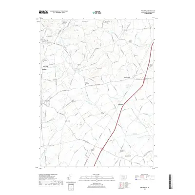
2019 Map of Biglerville
USGS Topo · Published 2019About this map
Fruit-growing country and rolling Adams County terrain define this landscape north of Gettysburg. The borough of Biglerville serves as a focal point, surrounded by agricultural settlements like Bendersville, Aspers, and Guernsey. The map reveals a dense network of local heritage sites, particularly the numerous historic burial grounds such as the Menallen Friends Cem and the Old White Episcopal Church Cem. To the east, Heidlersburg sits at a prominent crossroads near the Bermudian Cr, while the southern reaches include the village of Hunterstown. Significant landmarks like the Heikes Covered Bridge and the Bowtie Airport are noted alongside the winding paths of Conewago Creek and Opossum Cr, illustrating the area's mix of traditional rural infrastructure and early 21st-century aviation and transit corridors.
Find a feature on this map
131 named features on this map. Tap any name to fly to it.
Don’t see what you’re looking for? This feature index may not catch every label — zoom into the map to look around manually.
Map Details
Editions of this 2019 Biglerville Map
This is the sole edition of this map. No revisions or reprints were ever made.
Other maps of this area

1904 · Carlisle
USGS Topo · 1:62,500

1908 · Gettysburg
USGS Topo · 1:62,500

1909 · Fairfield
USGS Topo · 1:62,500

1919 · Newville
USGS Topo · 1:62,500

1942 · Gettysburg
USGS Topo · 1:125,000

1943 · Carlisle
USGS Topo · 1:62,500

1944 · Gettysburg
USGS Topo · 1:31,680

1944 · Mc Sherrystown
USGS Topo · 1:31,680

1944 · Arendtsville
USGS Topo · 1:31,680
1944 · Fairfield
USGS Topo · 1:31,680