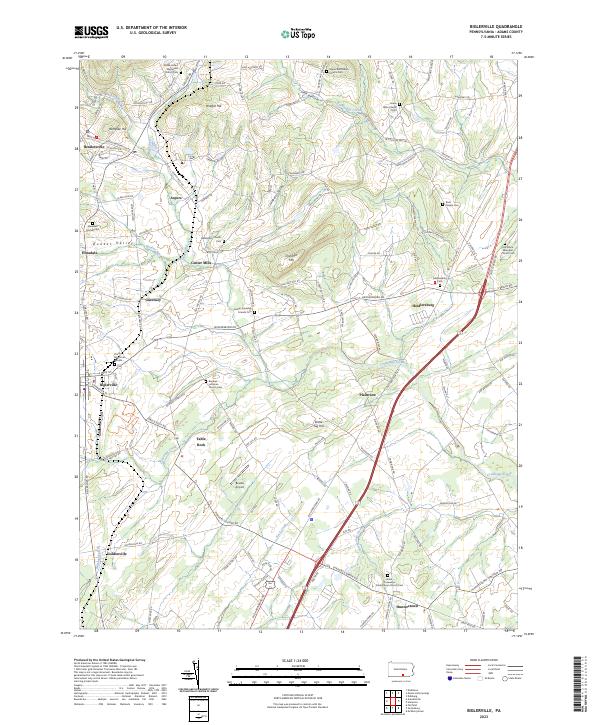
2023 Map of Biglerville
USGS Topo · Published 2023About this map
Bermudian Creek and Conewago Creek anchor this topographic view of north-central Adams County, a landscape defined by its long-standing orchards and rural crossroads. The area around Biglerville and Bendersville serves as a hub for local agricultural transit, with numerous family-named hills such as Wolfpit Hill and Chestnut Hill punctuating the terrain. For genealogists, the map is particularly rich in cemetery data, documenting sites like the Great Conewago Presbyterian Church Cem and the Menallen Friends Cem. Smaller settlements like Table Rock, Plainview, and Heidlersburg are connected by a network of historic routes including the Old Zeigler Mill Rd and Lime Rock Mill Rd, which trace the legacy of early milling along the creeks. The presence of the Bowtie Airport and the Trinity Memorial Garden illustrate the continued evolution of these established communities.
Find a feature on this map
131 named features on this map. Tap any name to fly to it.
Don’t see what you’re looking for? This feature index may not catch every label — zoom into the map to look around manually.
Map Details
Editions of this 2023 Biglerville Map
This is the sole edition of this map. No revisions or reprints were ever made.
Historical Maps of Tyrone Township Through Time
3 maps found