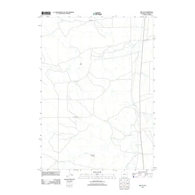
2012 Map of Bill SE
USGS Topo · Published 2012About this map
Ballard Ranch and Johnson Ranch anchor this landscape in Converse County, showing the persistent ranching legacy of the Wyoming plains in the early 21st century. The terrain is defined by its drainage network, where the intermittent waters of Box Cr and the winding course of Lightning Cr cut through the high prairie. These waterways, along with Little Lightning Cr and the Fiddleback Reservoir, illustrate the critical importance of water management in this arid environment.
Find a feature on this map
9 named features on this map. Tap any name to fly to it.
Don’t see what you’re looking for? This feature index may not catch every label — zoom into the map to look around manually.
Map Details
Editions of this 2012 Bill SE Map
This is the sole edition of this map. No revisions or reprints were ever made.
Other maps of this area

1949 · Sundquist Ranch
USGS Topo · 1:24,000

1949 · Clausen Ranch
USGS Topo · 1:24,000

1950 · Clausen Ranch
USGS Topo · 1:24,000
1950 · Sundquist Ranch
USGS Topo · 1:24,000

1954 · Torrington
USGS Topo · 1:250,000

1955 · Newcastle
USGS Topo · 1:250,000

1958 · Torrington
USGS Topo · 1:250,000

1958 · Newcastle
USGS Topo · 1:250,000

1959 · Bill
USGS Topo · 1:62,500

1970 · Bill 4 NW
USGS Topo · 1:24,000