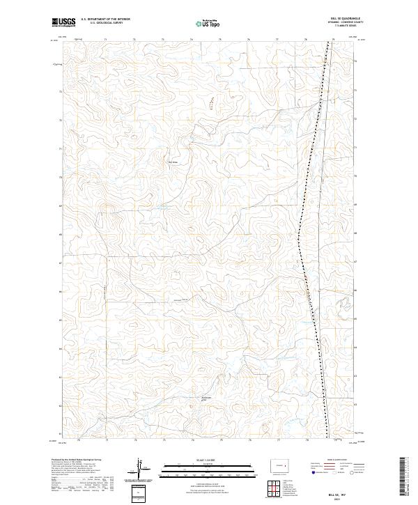
2021 Map of Bill SE
USGS Topo · Published 2021About this map
Highland Loop Road winds across this high plains landscape in southern Converse County, providing the primary access through a region defined by intermittent drainage systems and ranching infrastructure. The area is characterized by a network of seasonal watercourses, including Lightning Cr and Little Lightning Cr in the south, and Box Cr in the north. A significant point of interest for local history and land use is the Fiddleback Reservoir, which represents the essential water management required for livestock in this arid environment. The terrain is marked by prominent geological depressions like Alexander Draw and Dry Draw, illustrating the erosional patterns of the Wyoming basin. This 2021 survey by the U.S. Geological Survey details the township and range boundaries that continue to organize the rural landscape of eastern Wyoming.
Find a feature on this map
11 named features on this map. Tap any name to fly to it.
Don’t see what you’re looking for? This feature index may not catch every label — zoom into the map to look around manually.
Map Details
Editions of this 2021 Bill SE Map
This is the sole edition of this map. No revisions or reprints were ever made.
Other maps of this area

1949 · Sundquist Ranch
USGS Topo · 1:24,000

1949 · Clausen Ranch
USGS Topo · 1:24,000

1950 · Clausen Ranch
USGS Topo · 1:24,000
1950 · Sundquist Ranch
USGS Topo · 1:24,000

1954 · Torrington
USGS Topo · 1:250,000

1955 · Newcastle
USGS Topo · 1:250,000

1958 · Torrington
USGS Topo · 1:250,000

1958 · Newcastle
USGS Topo · 1:250,000

1959 · Bill
USGS Topo · 1:62,500

1970 · Bill 4 NW
USGS Topo · 1:24,000