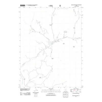
2011 Map of Billies Mountain
USGS Topo · Published 2011About this map
Billies Mountain rises as a prominent landmark in this region of Utah County, where the topography is defined by the drainage systems of Diamond Fork and the Spanish Fork. The landscape is etched with numerous steep drainages such as Wanrhodes Canyon, Brimhall Canyon, and Sams Canyon, which converge toward the main river valleys. Outdoor recreation is established at the Palmyra Campground and Diamond Campground, situated along the winding watercourses. High-elevation plateaus and openings like Wignal Flat and Monks Hollow suggest a terrain traditionally used for grazing or transit between the canyon floors. Significant access into the interior is provided by Diamond Fork Rd and Little Diamond Creek Rd, tracing the paths of Little Diamond Creek through the mountainous heart of the territory.
Find a feature on this map
16 named features on this map. Tap any name to fly to it.
Don’t see what you’re looking for? This feature index may not catch every label — zoom into the map to look around manually.
Map Details
Editions of this 2011 Billies Mountain Map
This is the sole edition of this map. No revisions or reprints were ever made.
Other maps of this area

1885 · Salt Lake
USGS Topo · 1:250,000

1885 · Manti
USGS Topo · 1:250,000

1895 · Manti
USGS Topo · 1:250,000

1907 · Strawberry Valley
USGS Topo · 1:125,000

1909 · Strawberry Valley
USGS Topo · 1:125,000

1948 · Springville
USGS Topo · 1:24,000

1949 · Provo
USGS Topo · 1:62,500

1949 · Spanish Fork Peak
USGS Topo · 1:24,000
1950 · Springville
USGS Topo · 1:24,000

1951 · Spanish Fork Peak
USGS Topo · 1:24,000