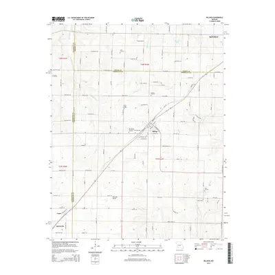
2015 Map of Billings
USGS Topo · Published 2015About this map
Billings and the southwestern edge of Republic anchor this landscape at the intersection of Christian, Greene, and Lawrence counties. The topography is defined by the headwaters of Turnback Creek and Pickerel Creek, with the elevation rising toward Coyote Ridge in the southeast. Significant for local family researchers, the map documents numerous small burial grounds such as Brashers Cemetery, Laney Cemetery, and Smart Cemetery. The BNSF Railway corridor cuts diagonally through the terrain, passing through Logan and toward Marionville, reflecting the historical transportation backbone of the region. Distinctive landmarks like McCullah Hollow and several denominational sites, including Saint Joseph Cemetery and Saint Peters Evangelical Cemetery, provide concrete reference points for tracing early Ozark settlements and land ownership patterns.
Find a feature on this map
107 named features on this map. Tap any name to fly to it.
Don’t see what you’re looking for? This feature index may not catch every label — zoom into the map to look around manually.
Map Details
Editions of this 2015 Billings Map
This is the sole edition of this map. No revisions or reprints were ever made.
Other maps of this area

1884 · Springfield
USGS Topo · 1:125,000

1886 · Greenfield
USGS Topo · 1:125,000

1886 · Springfield
USGS Topo · 1:125,000

1888 · Greenfield
USGS Topo · 1:125,000

1907 · Forsyth
USGS Topo · 1:125,000

1919 · Halltown
USGS Topo · 1:62,500

1936 · Brookline
USGS Topo · 1:24,000

1942 · Aurora
USGS Topo · 1:62,500

1945 · Harrison
USGS Topo · 1:250,000

1945 · Aurora
USGS Topo · 1:62,500