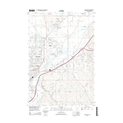
2014 Map of Billings East
USGS Topo · Published 2014About this map
Sacrifice Cliff and Skeleton Cliff stand as prominent geological sentinels over the winding Yellowstone River in this Montana study. The landscape is defined by the sharp vertical relief of the Rimrocks, which separate the river valley from the expanding residential blocks of Billings Heights and Billings Bench. This 2014 survey documents the complex irrigation infrastructure vital to the region, including the extensive Billings Bench Water Association Canal, Coulson Ditch, and Lockwood Ditch. Local history is anchored by the presence of Boothill Cem near the valley floor and Riverside Cem further east. The map captures a transition from the dense urban grid of Billings toward more open terrain near Hirsch, showcasing how the river has shaped the placement of transport routes like Montana Ave and Old Hardin Rd alongside islands such as Cherry Island and Dovers Island.
Find a feature on this map
157 named features on this map. Tap any name to fly to it.
Don’t see what you’re looking for? This feature index may not catch every label — zoom into the map to look around manually.
Map Details
Editions of this 2014 Billings East Map
This is the sole edition of this map. No revisions or reprints were ever made.
Other maps of this area

1893 · Huntley
USGS Topo · 1:125,000

1954 · Billings
USGS Topo · 1:250,000

1956 · Rattlesnake Butte
USGS Topo · 1:24,000

1956 · Hickson Ranch
USGS Topo · 1:24,000

1956 · Huntley
USGS Topo · 1:24,000

1956 · Yegen
USGS Topo · 1:24,000

1956 · Billings East
USGS Topo · 1:24,000

1957 · Billings
USGS Topo · 1:250,000

1957 · Billings West
USGS Topo · 1:24,000

1958 · Billings
USGS Topo · 1:250,000