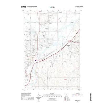
2020 Map of Billings East
USGS Topo · Published 2020About this map
The Yellowstone River cuts a prominent path through this 2020 topographic record, defining the growth of Billings and its surrounding communities. Along the northern banks, Billings Heights and the expansive Billings Bench showcase a landscape shaped by irrigation, evident in the intricate network of the Billings Bench Water Association Canal and the Miller and McGirl Ditch. To the south and east, the settlement of Lockwood and the industrial siding at Hirsch anchor the river's edge, while geological features like the Rimrocks, Skeleton Cliff, and the historic Sacrifice Cliff provide dramatic vertical relief against the valley floor. Genealogists and local historians can locate prominent resting places such as Boothill Cem and Riverside Cem, while tracing the development of residential corridors near Lake Elmo and across the numerous named islands like Cherry Island and Dovers Island.
Find a feature on this map
141 named features on this map. Tap any name to fly to it.
Don’t see what you’re looking for? This feature index may not catch every label — zoom into the map to look around manually.
Map Details
Editions of this 2020 Billings East Map
This is the sole edition of this map. No revisions or reprints were ever made.
Other maps of this area

1893 · Huntley
USGS Topo · 1:125,000

1954 · Billings
USGS Topo · 1:250,000

1956 · Rattlesnake Butte
USGS Topo · 1:24,000

1956 · Hickson Ranch
USGS Topo · 1:24,000

1956 · Huntley
USGS Topo · 1:24,000

1956 · Yegen
USGS Topo · 1:24,000

1956 · Billings East
USGS Topo · 1:24,000

1957 · Billings
USGS Topo · 1:250,000

1957 · Billings West
USGS Topo · 1:24,000

1958 · Billings
USGS Topo · 1:250,000