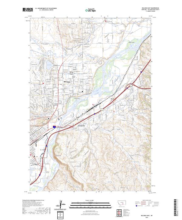
2024 Map of Billings East
USGS Topo · Published 2024About this map
The Yellowstone River cuts a prominent path through this landscape, dividing the urban expansion of Billings from the burgeoning community of Lockwood. To the north, Billings Heights and Billings Bench occupy the elevated terrain, where the Billings Bench Water Association Canal and Lake Elmo define the local hydrology. The area is anchored by significant historical landmarks, including the notable Boothill Cem and Riverside Cem near the riverbanks. The rugged geography is further marked by the high bluffs of Rimrocks, Skeleton Cliff, and Sacrifice Cliff, which loom over the valley. Extensive irrigation works like the Lockwood Ditch and Coulson Ditch reflect the agricultural engineering required to support development along the river’s north and south banks. This survey also documents the transition from older transport routes like Old Hwy 312 and Old Hwy 87 to the modern road network.
Find a feature on this map
37 named features on this map. Tap any name to fly to it.
Don’t see what you’re looking for? This feature index may not catch every label — zoom into the map to look around manually.
Map Details
Editions of this 2024 Billings East Map
This is the sole edition of this map. No revisions or reprints were ever made.
Other maps of this area

1893 · Huntley
USGS Topo · 1:125,000

1954 · Billings
USGS Topo · 1:250,000

1956 · Rattlesnake Butte
USGS Topo · 1:24,000

1956 · Hickson Ranch
USGS Topo · 1:24,000

1956 · Huntley
USGS Topo · 1:24,000

1956 · Yegen
USGS Topo · 1:24,000

1956 · Billings East
USGS Topo · 1:24,000

1957 · Billings
USGS Topo · 1:250,000

1957 · Billings West
USGS Topo · 1:24,000

1958 · Billings
USGS Topo · 1:250,000