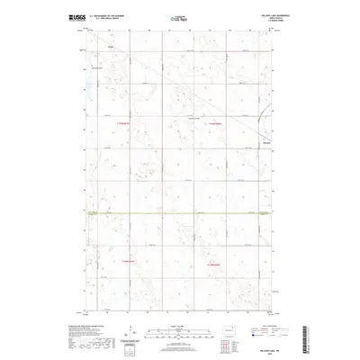
2020 Map of Billings Lake
USGS Topo · Published 2020About this map
Loma and Nekoma anchor this rural landscape in the northeast corner of North Dakota, situated within a region defined by an intricate network of sectional roads and watercourses. The drainage patterns of Edmore Coulee and Nekoma Coulee cut through the plains, illustrating the characteristic prairie pothole topography of the region. This survey captures the precise boundary where Cavalier Co meets Ramsey Co along 78th St NE, a line that historically dictated local administration and land ownership. The grid of north-south avenues, such as 100th Ave NE and 105th Ave NE, highlights the systematic township-and-range surveying that shaped the agricultural development of the Red River Valley hinterlands. This map reflects the enduring structure of these farming communities, where small settlements remain central points for the surrounding township sections.
Find a feature on this map
24 named features on this map. Tap any name to fly to it.
Don’t see what you’re looking for? This feature index may not catch every label — zoom into the map to look around manually.
Map Details
Editions of this 2020 Billings Lake Map
This is the sole edition of this map. No revisions or reprints were ever made.
Other maps of this area

1953 · Devils Lake
USGS Topo · 1:250,000

1956 · Devils Lake
USGS Topo · 1:250,000

1970 · Loma
USGS Topo · 1:24,000

1970 · Alsen SE
USGS Topo · 1:24,000

1972 · Derrick
USGS Topo · 1:24,000

1972 · Nekoma
USGS Topo · 1:24,000

1972 · Easby
USGS Topo · 1:24,000

1972 · Edmore
USGS Topo · 1:24,000

1972 · Edmore NE
USGS Topo · 1:24,000

1972 · Billings Lake
USGS Topo · 1:24,000