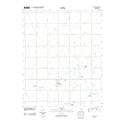
2009 Map of Billings
USGS Topo · Published 2009About this map
Billings serves as the central hub of this northern Oklahoma landscape, where the local economy is defined by a blend of agriculture and energy extraction. The presence of the East Billings Oil Field to the east of town highlights the region's industrial footprint, while the surrounding countryside is marked by a complex water management system. Numerous flood control structures, such as Upper Red Rock Creek Site 14 Reservoir and Upper Red Rock Creek Site 9 Reservoir, dot the drainage basins of Red Rock Creek and its tributaries like Bunch Creek and Ranch Creek. For those tracing local heritage, the Sacred Heart Cemetery and Billings Union Cemetery provide specific points of reference for the community's history. The map also captures the grid of rural routes, including named paths like W Cowboy Hill Rd and Kremlin-Hunter Rd, which connect the scattered farmsteads and resource sites.
Find a feature on this map
42 named features on this map. Tap any name to fly to it.
Don’t see what you’re looking for? This feature index may not catch every label — zoom into the map to look around manually.
Map Details
Editions of this 2009 Billings Map
This is the sole edition of this map. No revisions or reprints were ever made.
Other maps of this area

1955 · Enid
USGS Topo · 1:250,000

1956 · Garber
USGS Topo · 1:62,500

1958 · Enid
USGS Topo · 1:250,000

1968 · Lamont SE
USGS Topo · 1:24,000

1968 · Billings
USGS Topo · 1:24,000

1968 · Tonkawa SE
USGS Topo · 1:24,000

1968 · Eddy
USGS Topo · 1:24,000

1968 · Tonkawa
USGS Topo · 1:24,000

1968 · Lamont
USGS Topo · 1:24,000

1972 · Perry NW
USGS Topo · 1:24,000