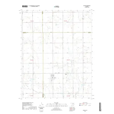
2018 Map of Billings
USGS Topo · Published 2018About this map
The town of Billings serves as the focal point of this agricultural landscape in north-central Oklahoma, situated near the intersection of the Garfield and Noble county lines. This 2018 survey detail shows a region heavily managed by water conservation efforts, evidenced by a series of flood control structures including Upper Red Rock Cr Site 9 Reservoir, Upper Red Rock Cr Site 13 Reservoir, and Upper Red Rock Cr Site 14 Reservoir. These man-made features are integrated into the natural drainage system of Red Rock Cr, Bunch Cr, and Hereford Cr. Local history is anchored by the community of Alcorn and significant local landmarks such as Billings Union Cem and Sacred Heart Cem. The map's grid layout, defined by roads like Kremlin-Hunter Rd and Zigzag, reflects the enduring legacy of the Public Land Survey System in organizing the prairie into productive farms and ranch lands.
Find a feature on this map
69 named features on this map. Tap any name to fly to it.
Don’t see what you’re looking for? This feature index may not catch every label — zoom into the map to look around manually.
Map Details
Editions of this 2018 Billings Map
This is the sole edition of this map. No revisions or reprints were ever made.
Other maps of this area

1955 · Enid
USGS Topo · 1:250,000

1956 · Garber
USGS Topo · 1:62,500

1958 · Enid
USGS Topo · 1:250,000

1968 · Lamont SE
USGS Topo · 1:24,000

1968 · Billings
USGS Topo · 1:24,000

1968 · Tonkawa SE
USGS Topo · 1:24,000

1968 · Eddy
USGS Topo · 1:24,000

1968 · Tonkawa
USGS Topo · 1:24,000

1968 · Lamont
USGS Topo · 1:24,000

1972 · Perry NW
USGS Topo · 1:24,000