
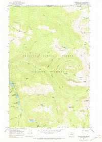
1969 Map of Billy Goat Mtn
USGS Topo · Published 1973About this map
Pasayten Wilderness and the Okanogan National Forest dominate this high-elevation landscape, captured during a 1969 field check. The terrain is defined by prominent summits such as Billy Goat Mtn and Big Craggy Peak, with several mines located near Eightmile Creek. The drainage patterns are clearly marked by high-altitude waters like Lower Fox Lake and No Dice Lake, while several high passes like Billy Goat Pass and Three Fools Pass indicate the primary routes through the peaks.
Find a feature on this map
38 named features on this map. Tap any name to fly to it.
Don’t see what you’re looking for? This feature index may not catch every label — zoom into the map to look around manually.
Map Details
Editions of this 1969 Billy Goat Mtn Map
2 editions found
Other maps of this area

1955 · Concrete
USGS Topo · 1:250,000

1958 · Concrete
USGS Topo · 1:250,000

1962 · Concrete
USGS Topo · 1:250,000

1962 · Mazama
USGS Topo · 1:62,500

1963 · Doe Mountain
USGS Topo · 1:62,500

1969 · Mt. Barney
USGS Topo · 1:24,000

1969 · Lost Peak
USGS Topo · 1:24,000

1969 · Remmel Mtn.
USGS Topo · 1:24,000
1969 · Ashnola Mtn
USGS Topo · 1:24,000

1969 · Billy Goat Mtn
USGS Topo · 1:24,000