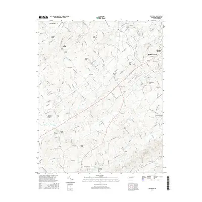
2016 Map of Binfield
USGS Topo · Published 2016About this map
Brick Mill and the surrounding Blount County countryside appear here as a patchwork of ridges and creek valleys, characterized by small settlements and numerous legacy burial grounds. The landscape is defined by its water and high ground, from the northern Pistol Br and Pistol Br down toward Ninemile Cr and the slopes of Chilhowee Mtn in the south. This 2016 survey documents the enduring spatial layout of rural communities like Big Springs, Binfield, and Mint, where local life has long clustered around landmarks such as Salem Cem and Hopewell Cem. The presence of McGraw's Backyard Airport and modern infrastructure provides a contemporary layer over an area rooted in the 19th-century road network, including the Indian Warpath Rd and Old Niles Ferry Rd.
Find a feature on this map
62 named features on this map. Tap any name to fly to it.
Don’t see what you’re looking for? This feature index may not catch every label — zoom into the map to look around manually.
Map Details
Editions of this 2016 Binfield Map
This is the sole edition of this map. No revisions or reprints were ever made.
Other maps of this area

1886 · Knoxville
USGS Topo · 1:125,000

1892 · Knoxville
USGS Topo · 1:125,000

1894 · Knoxville
USGS Topo · 1:125,000

1895 · Loudon
USGS Topo · 1:125,000

1895 · Knoxville
USGS Topo · 1:125,000

1901 · Knoxville
USGS Topo · 1:125,000

1935 · Binfield
USGS Topo · 1:24,000

1935 · Knoxville
USGS Topo · 1:48,000

1935 · Meadow
USGS Topo · 1:24,000

1935 · Maryville
USGS Topo · 1:24,000