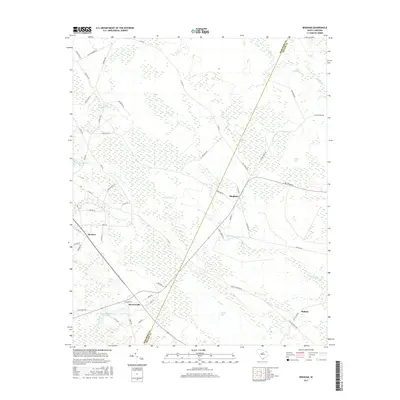
2017 Map of Bingham
USGS Topo · Published 2017About this map
Bingham and Bristow sit at the heart of this rural landscape where the border of Marlboro and Dillon Counties meets. The geography is defined by a series of Carolina bays—distinctive elliptical depressions such as Hilson Bay, Indigo Bay, and Catfish Bay—which dot the low-lying terrain. These features, along with extensive wetlands surrounding Little Reedy Cr and Reedy Cr, have historically shaped the drainage and agricultural patterns of the region. The map also documents local industry and water management through features like the Canal Industries Pond Dam near Brownsville. Numerous family-named roads, including McCallum Ln, Strickland Ln, and Taylor Ln, provide a detailed record of the local community and land ownership patterns as they existed in the late 2010s.
Find a feature on this map
51 named features on this map. Tap any name to fly to it.
Don’t see what you’re looking for? This feature index may not catch every label — zoom into the map to look around manually.
Map Details
Editions of this 2017 Bingham Map
This is the sole edition of this map. No revisions or reprints were ever made.
Other maps of this area

1942 · Rockingham
USGS Topo · 1:125,000

1943 · Gum Swamp
USGS Topo · 1:62,500

1953 · Florence
USGS Topo · 1:250,000

1954 · Florence
USGS Topo · 1:250,000

1960 · Latta
USGS Topo · 1:24,000

1960 · Dillon West
USGS Topo · 1:24,000

1971 · Minturn
USGS Topo · 1:24,000

1972 · Drake
USGS Topo · 1:24,000

1972 · Clio
USGS Topo · 1:24,000
1972 · Oak Grove
USGS Topo · 1:24,000