
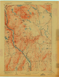
1905 Map of Bingham
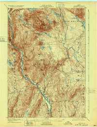
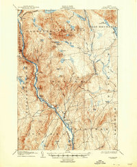
USGS Topo · Published 1939About this map
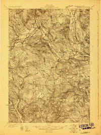
Bingham serves as the primary hub in this early 20th-century survey of the Kennebec valley, situated where the Maine Central railroad tracks meet the banks of the Kennebec River. The landscape is dominated by the steep drainages of the Bald Mountain range and the Austin Stream system, which feed into the river through numerous tributaries like Pleasant Pond Stream. The map reveals a wilder Somerset County interior, punctuated by clusters of named water bodies such as the Heald Ponds, Decker Ponds, and Mink Ponds.
Find a feature on this map
64 named features on this map. Tap any name to fly to it.
Don’t see what you’re looking for? This feature index may not catch every label — zoom into the map to look around manually.
Map Details
Editions of this 1905 Bingham Map
5 editions found
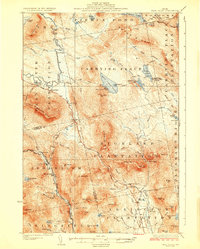
Other maps of this area

1903 · Bingham
USGS Topo · 1:62,500

1904 · Anson
USGS Topo · 1:62,500

1905 · Bingham
USGS Topo · 1:62,500

1905 · The Forks
USGS Topo · 1:62,500

1907 · The Forks
USGS Topo · 1:62,500

1913 · Skowhegan
USGS Topo · 1:62,500

1925 · Pierce Pond
USGS Topo · 1:48,000

1927 · Pierce Pond
USGS Topo · 1:62,500
1928 · Dead River
USGS Topo · 1:62,500
1930 · Kingfield
USGS Topo · 1:48,000