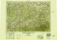
1950 Map of Binghamton
USGS Topo · Published 1951About this map
The Susquehanna River and Mohawk River valleys define this mid-century portrait of Central New York and the Northern Catskills. Centered on the industrial hub of Binghamton, the landscape is a complex network of river-cut valleys and upland plateaus. To the east, the Catskill Mountains rise sharply, dominated by peaks like Hunter Mt and Slide Mt. The map captures the region during a major period of hydraulic engineering, showing the Cannonsville Reservoir and Pepacton Reservoir along the branches of the Delaware River.
Find a feature on this map
181 named features on this map. Tap any name to fly to it.
Don’t see what you’re looking for? This feature index may not catch every label — zoom into the map to look around manually.
Map Details
Editions of this 1950 Binghamton Map
2 editions found

Other maps of this area

1892 · Kaaterskill
USGS Topo · 1:62,500

1893 · Kaaterskill
USGS Topo · 1:62,500

1893 · Schenectady
USGS Topo · 1:62,500

1893 · Coxsackie
USGS Topo · 1:62,500

1893 · Durham
USGS Topo · 1:62,500

1893 · Albany
USGS Topo · 1:62,500

1894 · Coxsackie
USGS Topo · 1:62,500

1894 · Kaaterskill
USGS Topo · 1:62,500

1894 · Durham
USGS Topo · 1:62,500

1895 · Chittenango
USGS Topo · 1:62,500