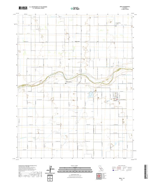
2021 Map of Biola
USGS Topo · Published 2021About this map
The San Joaquin River snakes through the heart of the San Joaquin Valley, defining the boundary between Madera and Fresno counties. This agricultural landscape is characterized by an intricate network of irrigation systems, including the Herndon Canal, Empire Ditch, and Ripperdan Ditch, which sustain the productive fields surrounding the small settlements of Biola and Ripperdan. The grid-like arrangement of roads, such as Madera Ave and Ripperdan Ave, illustrates the organized development of the region's farming infrastructure.
Find a feature on this map
71 named features on this map. Tap any name to fly to it.
Don’t see what you’re looking for? This feature index may not catch every label — zoom into the map to look around manually.
Map Details
Editions of this 2021 Biola Map
This is the sole edition of this map. No revisions or reprints were ever made.
Other maps of this area

1920 · Bonita Ranch
USGS Topo · 1:31,680

1921 · Bonita Ranch
USGS Topo · 1:31,680

1922 · Gregg
USGS Topo · 1:31,680

1922 · Madera
USGS Topo · 1:31,680

1923 · Kearney Park
USGS Topo · 1:31,680

1923 · Herndon
USGS Topo · 1:31,680

1923 · Biola
USGS Topo · 1:31,680

1924 · Jamesan
USGS Topo · 1:31,680

1924 · Gravelly Ford
USGS Topo · 1:31,680
1946 · Madera
USGS Topo · 1:62,500