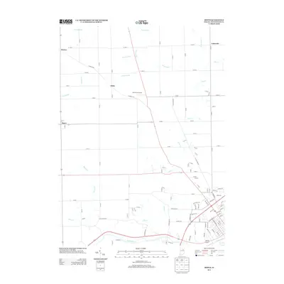
2013 Map of Bippus
USGS Topo · Published 2013About this map
The Wabash River and its confluence with the Little River anchor the southern reaches of this landscape in Huntington County. This rural Indiana terrain is heavily shaped by an intricate drainage system including the Brown Ditch, Carroll Ditch, and Deemer Ditch, reflecting the area's agricultural engineering. Scattered small communities such as Bippus, Makin, and Bracken are connected by a rigid grid of country roads, including W Bracken Rd. To the northeast, the settlement of Goblesville sits near the headwaters of W Br Clear Cr. The presence of the Beck Private Airport near the center of the sheet highlights the transition from traditional farming to modern infrastructure. For those researching local family history, the map provides precise locations for these smaller named hamlets and the waterways like Nieman Cr and Silver Cr that have long defined the regional property boundaries.
Find a feature on this map
54 named features on this map. Tap any name to fly to it.
Don’t see what you’re looking for? This feature index may not catch every label — zoom into the map to look around manually.
Map Details
Editions of this 2013 Bippus Map
This is the sole edition of this map. No revisions or reprints were ever made.
Other maps of this area

1950 · Lagro
USGS Topo · 1:24,000

1950 · Andrews
USGS Topo · 1:24,000

1951 · Andrews
USGS Topo · 1:24,000

1951 · Lagro
USGS Topo · 1:24,000

1952 · Majenica
USGS Topo · 1:24,000

1953 · Fort Wayne
USGS Topo · 1:250,000

1953 · Muncie
USGS Topo · 1:250,000

1955 · Bippus
USGS Topo · 1:24,000

1956 · Muncie
USGS Topo · 1:250,000

1956 · Fort Wayne
USGS Topo · 1:250,000