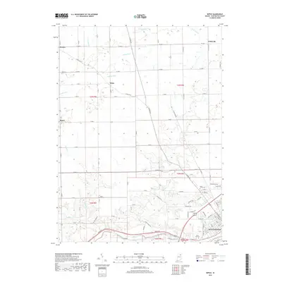
2019 Map of Bippus
USGS Topo · Published 2019About this map
The confluence of the Wabash River and Little River anchors the southeastern corner of this Huntington County landscape, where the Forks of Wabash Trail traces the historic watercourse. This region is defined by a dense network of agricultural drainage systems, including Carroll Ditch, Deemer Ditch, and Verdrick Ditch, which underscore the intensive land management required for Indiana's central plains. Smaller rural crossroads such as Bippus, Goblesville, and Makin serve as local hubs for the surrounding farmsteads. Genealogists will find a significant distribution of local burial sites, ranging from the isolated Funk Cem in the northwest to the larger Pilgrims Rest Cem and Mount Calvary Cem near the northern outskirts of Huntington. The map captures the transition from these small, unincorporated communities into the more developed industrial and residential corridors of the county seat.
Find a feature on this map
80 named features on this map. Tap any name to fly to it.
Don’t see what you’re looking for? This feature index may not catch every label — zoom into the map to look around manually.
Map Details
Editions of this 2019 Bippus Map
This is the sole edition of this map. No revisions or reprints were ever made.
Other maps of this area

1950 · Lagro
USGS Topo · 1:24,000

1950 · Andrews
USGS Topo · 1:24,000

1951 · Andrews
USGS Topo · 1:24,000

1951 · Lagro
USGS Topo · 1:24,000

1952 · Majenica
USGS Topo · 1:24,000

1953 · Fort Wayne
USGS Topo · 1:250,000

1953 · Muncie
USGS Topo · 1:250,000

1955 · Bippus
USGS Topo · 1:24,000

1956 · Muncie
USGS Topo · 1:250,000

1956 · Fort Wayne
USGS Topo · 1:250,000