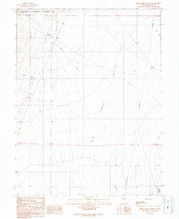
1989 Map of Birch Creek Ranch
USGS Topo · Published 1990About this map
Birch Creek Ranch and the small settlement of Birch anchor this high-desert landscape on the western edge of the Big Smoky Valley. This 1989 revision, based on field work dating back to 1960 and aerial photography from 1983, illustrates the rural infrastructure of central Nevada. The terrain is defined by the drainage of Birch Creek, Lynch Creek, and Tar Creek as they flow eastward from the foothills of the Toiyabe National Forest. The map documents a sparse network of unimproved roads and 4WD tracks that connect remote ranching sites with resource extraction points, such as various Borrow Pits and a prominent Transmission Line crossing the valley floor. The placement of section lines and the R 44 E and R 45 E boundaries provide a clear framework for those studying land use and historical property boundaries in Lander County.
Find a feature on this map
11 named features on this map. Tap any name to fly to it.
Don’t see what you’re looking for? This feature index may not catch every label — zoom into the map to look around manually.
Map Details
Editions of this 1989 Birch Creek Ranch Map
This is the sole edition of this map. No revisions or reprints were ever made.
Other maps of this area

1926 · Roberts Mountains
USGS Topo · 1:250,000

1929 · Roberts Mountains
USGS Topo · 1:250,000

1955 · Millett
USGS Topo · 1:250,000

1956 · Millett Ranch
USGS Topo · 1:62,500

1956 · Austin
USGS Topo · 1:62,500

1959 · Millett
USGS Topo · 1:250,000

1960 · Spencer Hot Springs
USGS Topo · 1:62,500

1960 · Wildcat Peak
USGS Topo · 1:62,500

1978 · Summit Mountain
USGS Topo · 1:100,000

1985 · Smith Creek Valley
USGS Topo · 1:100,000